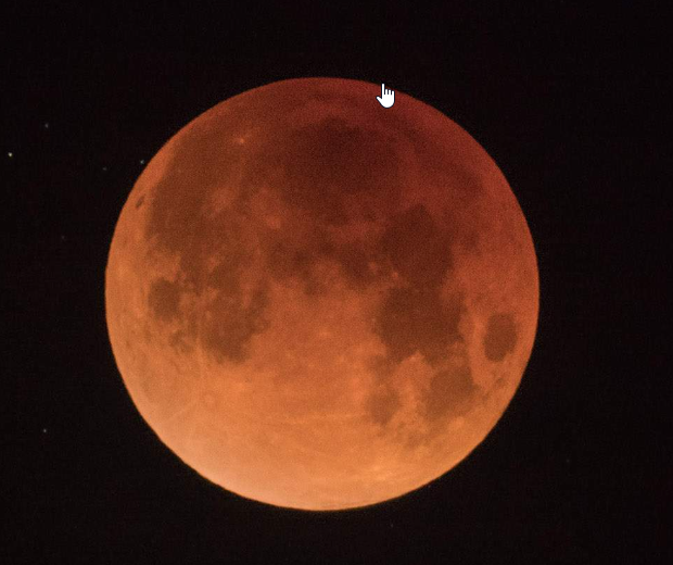
You may have heard that tomorrow night (Tuesday 8th Nov) in Australia we’ll have the pleasure of a total lunar eclipse. This happens when the Earth gets between the Sun and the Moon, thus cutting of most of the light that we normally see reflect off the Moon’s surface. What happens is that only a bit of the red wavelength manages to sneak through, and so we get the famed “blood Moon”.
Many people will have their cameras, camcorders and smartphones primed for the event, but the trick is knowing exactly when it will happen. If at all.
For example, here in the SW of Western Australia, it will be between 5pm and 7:30pm, and the sun won’t have even set, so we’ll see, well, bugger all.
Conversely, in Hobart, Taswegians will have the spectacle between 8pm-ish and nearly midnight so will have a ripper show!
So, how do you calculate exactly what time you can get that perfect photo or video, no matter you live in Dubbo or downtown Cooper Pedy?
I first started to (again) dabble in photo and video astronomy just before the pandemic, and over the ensuing period I found a brilliant app called PhotoPills that is sort of a Swiss Army knife for all things astro.
It will calculate for you the exact time of celestial events (sunrise, sunset, moonrise, planet rise, meteor showers etc) for any known location. So, say you want to get the sunrise coming up over the lighthouse at Barrenjoey Headland or Byron Bay, it will work out EXACTLY where you need to be location wise, and at what time to be there.
For camera alignment to get star trails, or aligning a tracking device like the MSM, it will quickly allow you to set up the equipment, so you don’t get errors with streaking and so on.
It has a whole bunch of other stuff too such as aids in working out depth of field, field of view, hyperfocal tables, exposure and much, much more.
Back to the lunar eclipse planning though …
To work this out for your location, there are a number of easy steps to follow using PhotoPills.
- Open up the app (Android or iOS) and choose Planner
- You may be asked whether you want Precise or Approximate locations to be calculated. Use precise
- A Google Earth image will open with a series of coloured lines intersecting at your location and a stack of statistical and other info at the top and bottom.

- At the bottom right-hand corner of the map is a Plus sign and an icon showing two diamond shapes. This latter is the Map Settings button. Tap this to open and then under Map Layers, choose Eclipse. This will open the Solar and Lunar eclipses calendar.

- Find the date (8/11/2022) and tap on that and then return to the map. This will now be set at the exact date / time of the eclipse.
- You can now zoom the map out and see all the eclipse information on the map.

- Next, swipe the top panel (above the map) to the left until you see the Eclipse data.
- The lines on the map show the stages of the eclipse of the Moon as it travels around the Earth. As you can see there are areas where they will not see the eclipse at all (African continent, Alaska etc).
- Let’s assume you want to see the times and other information on the eclipse from a location not where you are. To do this, tap the load button and enter the location. I’ve chosen Port Hedland. The map is now reset with all the Lunar eclipse info set to Port Hedland.
- You’ll notice that the lines on the map have different labels – P1, U1, U2, U3 and so on. These relate to the phases of the eclipse – the Penumbral and Umbral. The data above the map matches these phases as the Moon moves through the eclipse stages. So in the case of Port Hedland, the eclipse starts at around 3:10pm when the Moon starts to enter the Earth’s shadow, total eclipse is at 7:00pm exactly and it’s all over at 9:57pm.
- Both the top panel and bottom panel can be manipulated by taps and holds to see the eclipse info at different times.
- The thin blue line next to the thicker one shows the actual path of the Moon.
All the steps above now give you all the data you need to actually plan the shot / video.
Now here comes the clever part of PhotoPills. Or one of them anyway.
 The app has a built in Augmented Reality system (the AR button down the bottom), Tap that, and the data will overlay the scene shown in your device’s camera and show you EXACTLY where the Moon will be in the sky. You have available the horizon and a compass plus the position (height)n of the Moon letting you set the camera up precisely for any required shot.
Tie all this information together, and you can now plan your shoot precisely. Say for example you want to catch the total eclipse over the top of the Sydney Opera House, or Ayres Rock – sorry Uluru – then you know exactly where you need to be, at what time and the position of the camera.
It does take a little experimentation and playing with PhotoPills. It is one of those programs whose depths you may never plumb to the fullest. But in the process, you will certainly have the ability and wherewithal’s to get those killer photos you see in the likes of national geographic etc.
At the PhotoPills website, there is a whole bunch of tutorials to walk you through various scenarios too and to get full use of the app. They also have a free e-Book you can download.
Tip: A great skill to learn for this sort of stuff is compositing in Adobe Photoshop. This image by Jose A Hervas was created using that functionality.

PhotoPills costs $9.99 (bargain!) and is available from Google Play and the App Store.